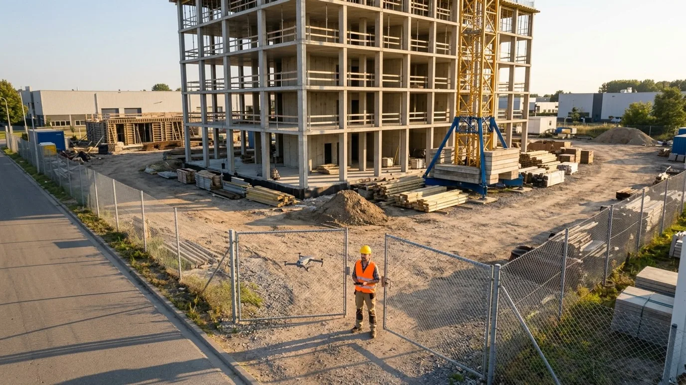
Construction progress monitoring
Progress captures your stakeholders can actually read.
Same vantage points, same schedule, every visit. A timestamped aerial record of the whole site that owners, lenders and your own PMs can follow without a site walk.
Canada-wide · Transport Canada Advanced RPAS · Commercially insured
One record of the site that everyone can point at.
This is for general contractors, project managers and owners' representatives who have to report progress to someone who is not on site. Lenders, out-of-town owners, joint venture partners, a head office. People who ask "where are we" and need an answer they can see.
The problem with the photos most sites already take is that they are taken from the ground, from wherever the person happened to be standing, on whatever day they remembered. They show a wall. They do not show the site, and they cannot be compared month to month.
A scheduled aerial capture fixes that. Same vantage points, same headings, same schedule. The result is a timestamped record of the whole site that holds up in a progress meeting, in a claim, and in a payment certification where someone needs to verify work in place before releasing money. This is reality capture in the plain sense: a record of what was actually built, when, that nobody has to argue about.
Documentation and disputes
Dated, from the same spot
A timestamped visual record that supports work in place verification, RFIs and change orders when memory and ground photos are not enough.
Remote visibility
No site walk needed
Owners, lenders and head office see the whole site the way it actually is, without a drive or a flight to get there.
Schedule and payment
Verify before you pay
Check claimed progress against what the air shows before certifying a draw, and bring one shared view into OAC meetings.
Deliverables
What you get
Fixed vantage point photo set
High resolution stills from the same positions and headings every visit, geotagged, so month to month comparison is direct.
Site overview video
A short stabilised flyover along a repeatable path. Muted, no music, ready to drop into an update deck or send to an owner.
Progress comparison sheets
This visit beside the last one, from each vantage point, as a PDF. The page most people open in an OAC meeting (the owner, architect and contractor progress meeting).
Orthomosaic (optional)
A single, measurable top-down map of the site stitched from hundreds of overlapping photos. GeoTIFF plus a web viewer. Add it when you need to measure, not just look.
360 aerial panorama (optional)
One interactive view from above the site that a viewer can spin and zoom. Useful for people who have never been on site.
Named, dated, organised
Every file carries the capture date and vantage point in its name and metadata. Folders by visit. Nothing to sort before you share it.
- Turnaround
- Agreed at scoping, matched to your reporting cycle
- Delivery
- Shared cloud folder per project, or into the platform your team already uses
- Licensing
- You own every file, for any use. We never publish your site without written permission.
What it looks like
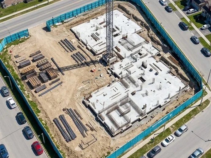
Month 1Same vantage point 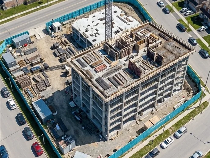
Month 2Same heading, same time of day Progress comparison sheet
Two captures from the same fixed vantage point. This is the page that opens in the OAC meeting.

Orthomosaic
One measurable, straight-down map of the whole site, stitched from hundreds of photos.
How it works
Four steps. You do the first one.
Scope it once. After that the programme runs on its own schedule and the files show up.
Scoping call
Fifteen minutes. Who reads the report, how often you need it, and what must be visible: foundations, envelope, laydown, access, all of it.
Baseline capture
The first visit sets the vantage points and the flight path, clears airspace, and attends your site briefing. It becomes the reference for every visit after.
Repeat on schedule
Same positions, same headings, same time of day where possible. Weekly, biweekly or monthly. You see the site change, not the camera angle.
Delivered and compared
Organised files and comparison sheets in your folder or platform. A note flags anything that looks off from the air.
01
Scoping call
Fifteen minutes. Who reads the report, how often you need it, and what must be visible: foundations, envelope, laydown, access, all of it.
02
Baseline capture
The first visit sets the vantage points and the flight path, clears airspace, and attends your site briefing. It becomes the reference for every visit after.
03
Repeat on schedule
Same positions, same headings, same time of day where possible. Weekly, biweekly or monthly. You see the site change, not the camera angle.
04
Delivered and compared
Organised files and comparison sheets in your folder or platform. A note flags anything that looks off from the air.
Compliance
Compliance, in plain terms
Nothing here is a selling point. It is the minimum you should demand from anyone who flies on your site.
Transport Canada Advanced RPAS certificate
The advanced certificate is the one that permits flight in controlled airspace and near people. Every operator Lensdrone dispatches holds it.
Commercial liability insurance
Insured for commercial RPAS operations. Certificate of insurance available on request, naming your company where required.
NAV CANADA airspace authorisation
Controlled airspace near airports needs authorisation before each flight. We handle the request and build the lead time into scheduling.
SFOC where needed
Some operations, such as flights over 122 m or beyond visual line of sight, need a Special Flight Operations Certificate. We tell you up front if your job needs one and manage the application.
Site safety briefing
We attend your site orientation, follow your PPE and access rules, and brief your team on where and when we are flying.
Pricing
Quoted per project. Tell us about the site and you get a scope and a number.
What moves it
- Site area and how many vantage points it takes
- Capture frequency, since a recurring programme costs less per visit than a one-off
- Whether you want an orthomosaic and volumes on top of photo and video
- Travel, if the site is far from the nearest operator
In practice
What it looks like on a real job
General contractor, mixed-use development
Mixed-use residential, structure and envelope phases
- The problem
- An out-of-province owner was relying on ground-level phone photos and could not tell from one month to the next what had actually changed.
- What we captured
- Monthly captures from eight fixed vantage points, a flyover video and a comparison sheet, for the length of the structure and envelope phases.
- What changed
- The comparison sheet became the first page of the monthly owner report. Questions about schedule stopped arriving by email and started being answered in the meeting.
FAQ
Questions people ask before booking
We already take progress photos. Why would we pay for this?
Ground photos show a wall. Aerial captures from fixed positions show the whole site, the same way, every time. The difference matters when someone who was not there needs to understand what changed, or when there is a dispute about when work was done. Most of our clients keep taking their own photos. Ours are the record they hand to the owner.
Is this only for large, multi-year projects?
No. The smallest programmes we run are a few visits over a single earthworks or envelope phase. What matters is whether someone off site needs to see progress. If they do, the size of the job is not the deciding factor.
Does this work with Procore, Autodesk Construction Cloud, DroneDeploy or Pix4D?
Yes. Files can go into your Procore or ACC project. If your team already uses DroneDeploy, Pix4D or Propeller, we capture to that platform’s flight spec and deliver into your account. See the flights for your platform page for the detail.
What if our site is in controlled airspace?
Most urban sites are. Every operator we dispatch holds the Advanced RPAS certificate, which is the one that permits controlled airspace flight, and we request NAV CANADA authorisation before each visit. It adds lead time to the first capture, rarely to the cost.
Who owns the data?
You do. Every photo, video and map is yours to use however you want, with no licensing fee and no expiry. We keep a copy for the duration of the project in case a file goes missing on your side, then delete it unless you ask us to keep it.
How fast can you be on site?
It depends on where the site is and whether airspace authorisation is needed. Tell us the location and we will give you a date. Ben flies personally where he can and dispatches a vetted, licensed, insured operator elsewhere in Canada. Either way, Lensdrone is the one accountable operator of record.
What happens in winter?
We fly in winter across Canada. Cold shortens battery life and low sun changes the look of the images, so we plan for shorter flights and midday captures. Heavy snow or freezing rain will move a visit by a day or two, and we tell you as soon as we know.
Next step
Tell us about the site.
Anywhere in Canada. Send the basics and Ben will come back as soon as he can with a scope and a price. If you would rather talk, call.
- Call Ben
- +1 778 889 9306
- [email protected]
- Ballpark in 60 seconds
- Instant estimate