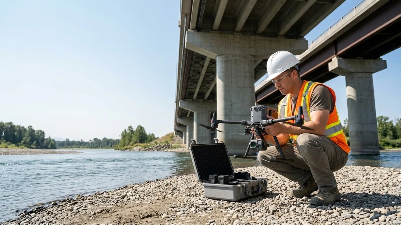
Infrastructure and municipal
Bridges, roads, dams and public assets, documented without closing them.
Condition capture, mapping and progress records for municipalities, engineering consultants and civil contractors. No lane closures, no snooper trucks, no one over the edge.
Canada-wide · Transport Canada Advanced RPAS · Commercially insured
Public assets, documented to a standard a council can rely on.
This is for municipal engineering and public works departments, consulting engineers and civil contractors responsible for bridges, culverts, roads, dams, facilities and parks.
A conventional condition inspection means a lane closure, a lift or a bucket truck, and someone over the edge. It happens less often than it should because of what it costs to set up.
A drone captures the underside of a deck, the face of a spillway and the length of a corridor in a fraction of the time, with nothing closed and no one at height. The record is systematic, dated and georeferenced, which is what an asset management programme actually needs.
Condition
The underside, the face, the deck
Systematic high resolution capture of the parts of a structure that otherwise need a lift, a boat or a closure to see.
Asset records
Mapped and measurable
Orthomosaics and models of corridors, facilities and sites that drop into your GIS as a dated layer.
Safety and disruption
No closure, no one at height
Traffic keeps moving, crews stay on the ground, and the record is better than the one a bucket truck produces.
Deliverables
What you get
Systematic inspection imagery
High resolution stills organised by element (piers, abutments, bearings, deck, railings, spillway, face), with a location key.
3D model of the structure
Photogrammetric model for engineers to review geometry, spalling, cracking and settlement in context, viewable in a browser.
Corridor and site orthomosaics
Roads, right-of-ways, facilities and parks mapped as georeferenced GeoTIFF layers for your GIS.
Elevation models
DSM and DTM for drainage review, floodplain work and earthworks quantities.
Findings summary
A plain-language summary of what was observed, located on the model or plan. Engineering assessment stays with your engineer.
Dated baseline
Repeatable capture positions so the next inspection cycle compares directly.
- Turnaround
- Agreed at scoping, matched to your inspection cycle or reporting date
- Delivery
- Shared folder, GIS-ready layers, browser model viewer
- Licensing
- You own every file. Public bodies may publish freely.
What it looks like
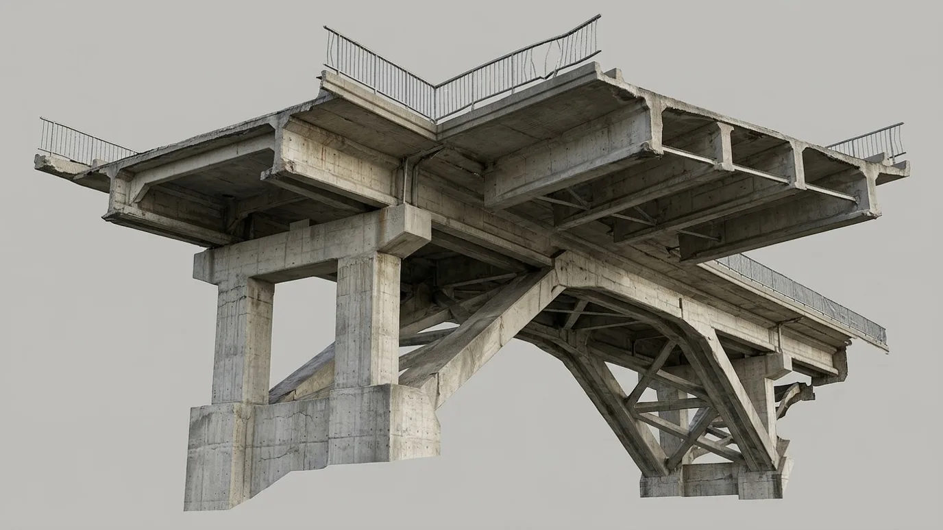
3D model of the structure
Photogrammetric model of a bridge for geometry, spalling and settlement review.
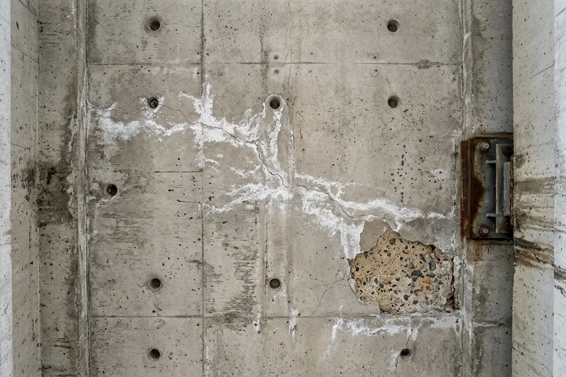
Systematic inspection imagery
Close-range, square-on, at a resolution where a crack and efflorescence are unmistakable.
How it works
Scope, authorise, capture, deliver.
Infrastructure jobs often need an SFOC or a NAV CANADA authorisation. We build that lead time in from the start.
Scoping call
Which assets, what your engineer needs to see, what your GIS needs to receive, and the inspection cycle it fits into.
Authorisation
NAV CANADA airspace request, and a Special Flight Operations Certificate where the operation needs one. We handle the paperwork and tell you the date.
Capture
Systematic flight around and under the structure or along the corridor. Traffic control only where your own policy requires it.
Deliver
Imagery by element, model, map layers and the summary. A walkthrough call with your engineer if useful.
01
Scoping call
Which assets, what your engineer needs to see, what your GIS needs to receive, and the inspection cycle it fits into.
02
Authorisation
NAV CANADA airspace request, and a Special Flight Operations Certificate where the operation needs one. We handle the paperwork and tell you the date.
03
Capture
Systematic flight around and under the structure or along the corridor. Traffic control only where your own policy requires it.
04
Deliver
Imagery by element, model, map layers and the summary. A walkthrough call with your engineer if useful.
Compliance
Compliance, in plain terms
Nothing here is a selling point. It is the minimum you should demand from anyone who flies on your site.
Transport Canada Advanced RPAS certificate
The advanced certificate is the one that permits flight in controlled airspace and near people. Every operator Lensdrone dispatches holds it.
Commercial liability insurance
Insured for commercial RPAS operations. Certificate of insurance available on request, naming your company where required.
NAV CANADA airspace authorisation
Controlled airspace near airports needs authorisation before each flight. We handle the request and build the lead time into scheduling.
SFOC where needed
Flights over roads and near structures often need a Special Flight Operations Certificate, and some corridors justify beyond visual line of sight. We identify the requirement at scoping and manage the application so it does not hold up your date.
Site safety briefing
We attend your site orientation, follow your PPE and access rules, and brief your team on where and when we are flying.
Pricing
Quoted per project. Tell us about the site and you get a scope and a number.
What moves it
- Asset type and length
- SFOC requirements
- Report and data format
In practice
What it looks like on a real job
Municipal engineering department
Bridge and culvert condition programme
- The problem
- A programme of small bridges and culverts due for condition review, each one previously needing a lane closure and a lift.
- What we captured
- Systematic imagery and a 3D model of each structure, captured over two days, delivered by asset number.
- What changed
- The engineer reviewed every structure from a desk and sent the crew to the three that needed hands-on attention.
FAQ
Questions people ask before booking
Is this an engineering inspection?
No. It is the visual record an engineer inspects from. Your professional engineer assesses condition and signs off; we make sure they have every surface, at resolution, in context.
Can you fly under a bridge deck?
Yes, where the clearance and the airspace allow it. The aircraft holds position without GPS under a deck and the imagery is captured systematically along each girder and pier.
Do you need a road closure?
Usually not. Flights are planned so the aircraft is not over live traffic, or the operation is authorised under an SFOC where overflight is unavoidable. Your traffic management policy decides the rest.
How does procurement work with a municipality?
We are incorporated, insured and able to provide a certificate of insurance naming the municipality. We respond to RFQs and can work under a standing offer for recurring inspection cycles.
What about winter and shoulder season?
We fly year-round. Cold shortens flight time and low sun affects imaging, so winter captures are planned for midday and shorter sorties. Ice and snow on a structure limit what can be observed, which we say plainly in the summary.
Who owns the data?
You do. It sits in your asset management system for as long as you want it, with no licence and no expiry.
Next step
Tell us about the site.
Anywhere in Canada. Send the basics and Ben will come back as soon as he can with a scope and a price. If you would rather talk, call.
- Call Ben
- +1 778 889 9306
- [email protected]
- Ballpark in 60 seconds
- Instant estimate